[from Deep-Sea Life Issue 14]
Southeast Deep Coral Initiative (SEDCI): Research Highlights in 2019
Rachel Bassett (1), Caitlin Adams (1), Tim Battista (2), Kate Overly (3), Dan Dorfman (1) & Peter Etnoyer (2)
(1) NOAA affiliate with CSS, Inc., (2) NOAA NCCOS, (3) NOAA affiliate with RTI, Inc.
SEDCI is a multiyear, cross-line-office project, funded by NOAA’s Deep
Sea Coral Research and Technology Program. The initiative has been
exploring and documenting deep-water seafloor habitats (> 50 m) in
the Caribbean Sea, Gulf of Mexico, and Southeastern US EEZ since
2016.
In 2019, five expeditions were conducted in partnership with NOAA
Office of Ocean Exploration (OER) and NOAA Coral Reef Conservation
Program (CRCP). Altogether, researchers spent a total of 88 days at sea
in the Atlantic and Caribbean, mapping over 50,000 square kilometers
with 82 remotely operated vehicle (ROV) dives between November 2018 and November 2019.
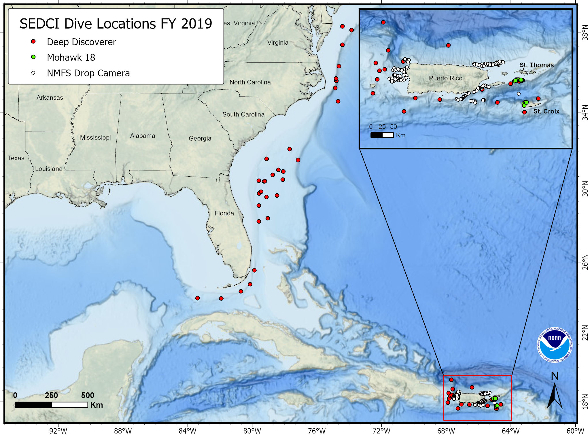
Three of the NOAA OER expeditions characterized extensive Lophelia coral habitats in the Northwest Atlantic on the Blake Plateau. Field teams mapped and explored “Richardson Hills” reef complex and the “Million Mounds” area, the largest extent of Lophelia reef habitat currently known in US waters. Follow these links to view the expedition websites: DEEP SEARCH 2019, Windows to the Deep 2019, and the 2019 Southeastern U.S. Deep-sea Exploration.
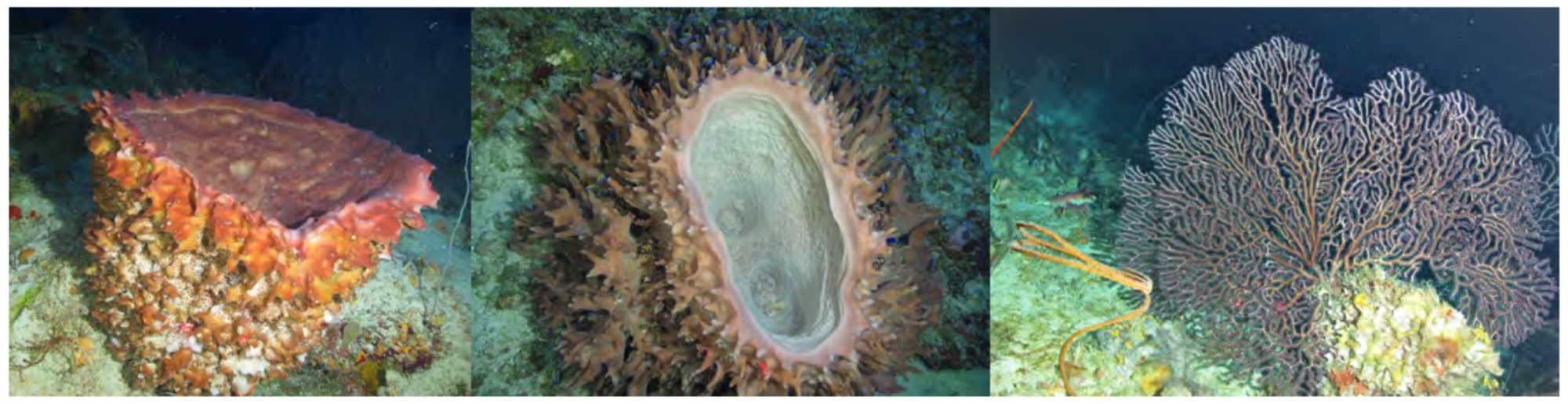
In the U.S. Caribbean, researchers conducted surveys aboard the NOAA Ship Nancy Foster in the fifteenth year of coral ecosystem investigations supported by NOAA’s CRCP. The ongoing project is mapping coral reef ecosystems in the U.S. Virgin Islands and Puerto Rico down to 300 m depth. The 2019 cruise collected samples for the first time. The team collected octocoral and black corals to support habitat models, contribute to population connectivity studies, and develop new field guides. Sonar was used to determine distribution and size of fish. Over 170 square miles were
mapped in St. Croix and St. Thomas in depths from 11-324m. ROV surveys traversed 12 km, collecting HD video for benthic habitat characterization. The northwest shelf of St. Croix, USVI was previously unmapped and unexplored. These data will assist policy makers and managers regarding essential coral reef ecosystems in the USVI.
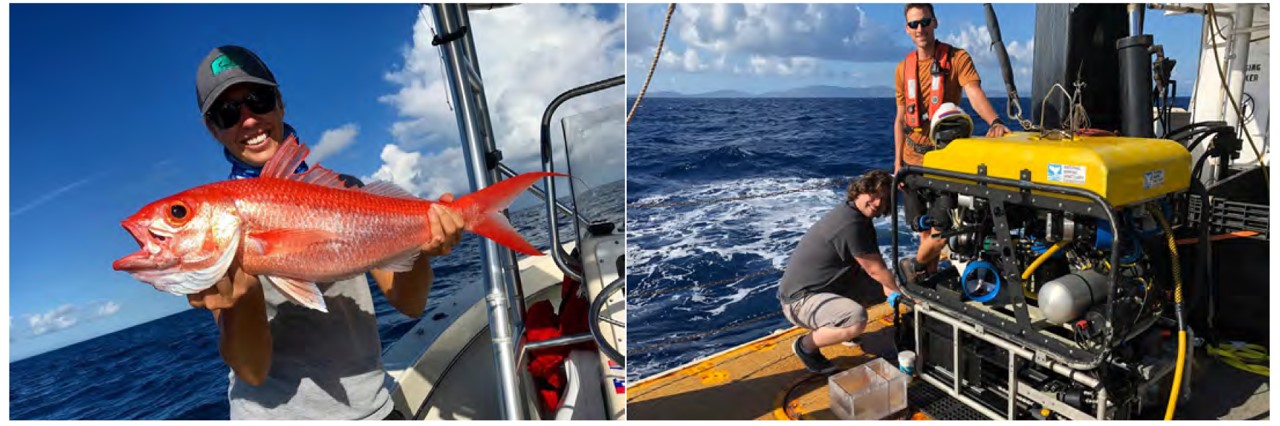
Nearby in Puerto Rico, scientists from NOAA National Marine Fisheries Service worked with commercial fishermen to gather information on habitat association and life history of the Queen Snapper – a valuable but little-known fisheries resource. Vertical longlines were used to deploy cameras to capture video of 215 Queen Snapper sites. Preliminary data show deep corals in 78 percent of sites on the West coast, 61 percent in the Southeast and 17 percent in the Northeast. Sixty-six fish species were seen and 46 Queen Snapper were caught for age and growth studies. A total of
225 stations should be completed in summer 2020. The knowledge gained in this study will inform future ecosystembased management decisions.
To bring these data together and make it public, SEDCI developed a web-accessible geodatabase designed to share maps, observations, submersible dive locations, and managed area boundaries. NOAA’s National Database of Deep-sea Corals and Sponges is served directly from the National Centers for Environmental Information. Bathymetric contours, a 1 km grid of coral abundance, ports and harbors, and up-to-date managed area information are also available.
For more information, contact