[from Deep-Sea Life Issue 14]
E/V Nautilus telepresence exploration of the U.S. Line Islands (Kingman Reef, Palmyra Atoll, and Jarvis Island)
Steve Auscavitch (1) & Rob Pockalny (2)
(1) PhD Candidate, Temple University, Philadelphia, PA; (2) Marine Research Scientist, University of Rhode Island, Graduate
School of Oceanography
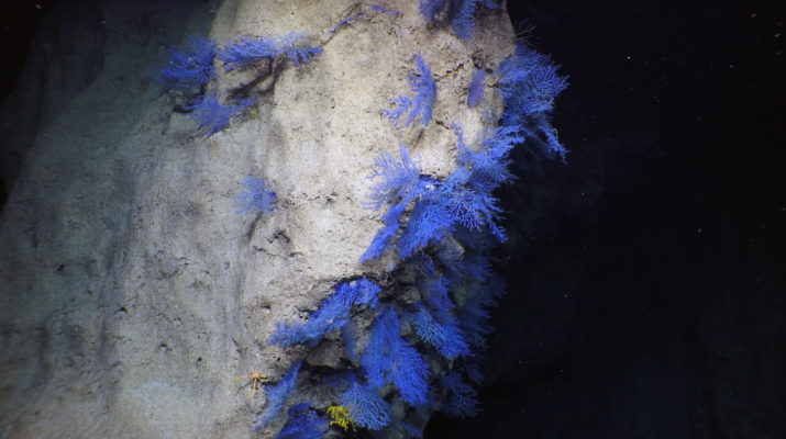
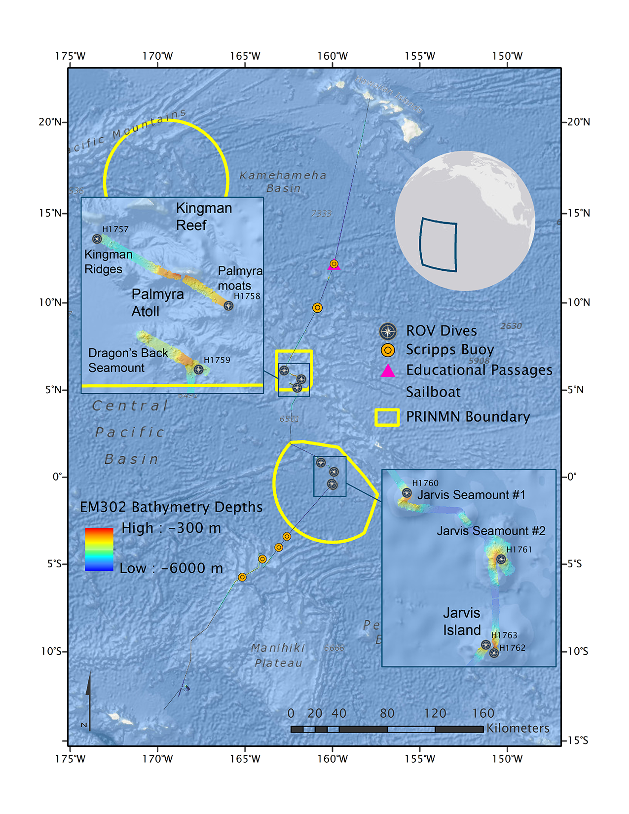
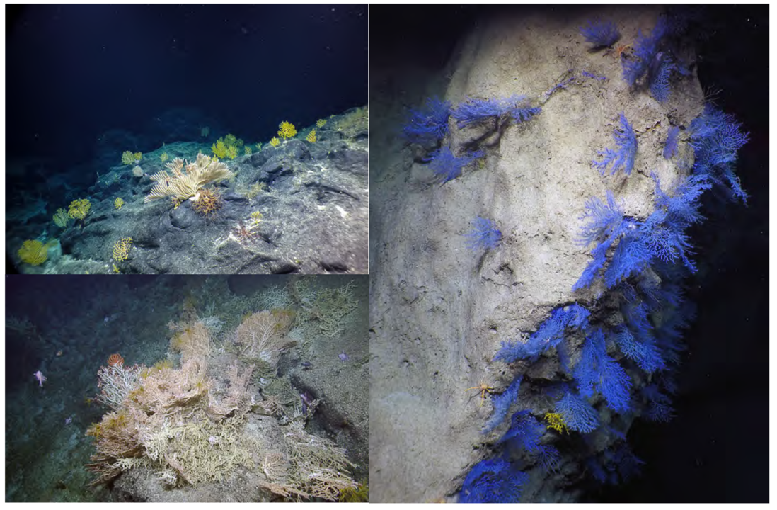
In June and July 2019, the E/V Nautilus and ROV Hercules explored the Kingman Reef & Palmyra Atoll and Jarvis Island units of the Pacific Remote Islands Marine National Monument. This expedition was a follow-up on recent explorations throughout the Pacific as a part of the 2013-2015 NOAA Campaign to Address Pacific Monument Science Technology and Ocean Needs (CAPSTONE). Previous expeditions had provided brief glimpses at the geological composition and biological diversity of the deep-sea environment. This expedition focused on leveraging previous mapping and exploration dives in order to maximize bottom time and sampling effort at undersampled locations within the units. Across 7 dives, we accumulated 117 hours of bottom time and traversed approximately 23 linear km of seafloor on seamounts, ridges, and island flanks. Biological sampling resulted in 76 primary collections, including 64 deep-water corals, sponges, as well as their associates. Biological collections targeted individuals that represented characteristic fauna for the area, new records for the Line Islands, or potential new species requiring further examination by taxonomic experts. In support of geological studies, 39 rocks were collected to better understand seamount ages as well as characterizing the composition of regional ferromanganese crusts. In total, 28,340 km2 of seafloor were mapped both in transit between sites and while gap-filling partially mapped seamounts.
Immediate follow-up work to this expedition will focus on identifying high-diversity and high-density deep-water benthic communities from annotation of ROV video and identification of collected specimens. Ultimately, these data are valuable additions to management efforts that seek to identify and characterize biodiverse communities and features within monument boundaries and other data-deficient areas of the central Pacific Ocean.
Expedition links:
Blog: https://nautiluslive.org/blog/2019/06/24/exploring-deep-waters-kingman-reef-palmyra-atoll-and-jarvis-island
Overview of deep-sea coral diversity: https://nautiluslive.org/album/2019/07/11/get-know-deep-sea-corals-centralpacific
Benthic biodiversity gallery: https://nautiluslive.org/album/2019/07/08/standout-biodiversity-pacific-remote-islandsmarine-
national-monument